A step into history
The Precinct known as Blackwattle Bay has a rich history – an important place for Eora women and later an important industrial land which has since become home to the Sydney Fish Market.
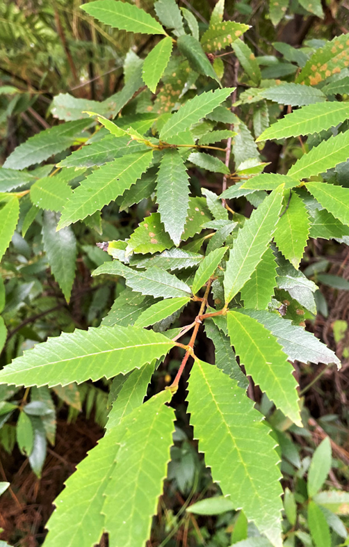
‘Tjerruing’ Blackwattle Bay
Tjerruing, is pronounced ‘Ger-ru-ring’.
Blackwattle Bay Country is known as Tjerruing (Callicoma Serratifolia), a flora species which grew prolifically along the creekline and was given the common name ‘blackwattle’ by British colonists. Despite the English misnomer, Tjerruing is not a wattle. It has spherical lemon-yellow fluffy flowers that appear similar to those of the local acacia species (such as acacia decurrens and acacia parramattensis) which were also assigned the misnomer ‘blackwattle’ in the early days of the colony after their suitability for mimicking the wattle and daub houses built in Britain.
Lomandra grass is also an important hardy plant used in the area, as it has long and flat green leaves which were used for food and making artefacts by Aboriginal people. The long green blades were chewed on the end for hydration and nourishment as well as making useful things such as baskets.
FUN FACT
Tjerruing is a popular and important plant. When Tjerruing is grown around other specific species it has the potential to enhance the health and survival of the other plants as well as increase the effectiveness of their active ingredients and medicinal qualities
DID YOU KNOW?
There are six seasons observed by Aboriginal people. The Precinct falls within the D’harawal Calendar, local to the Sydney region. Tjerruing (Callicoma Serratifolia) flowers during Ngoonungi, which is around September to October.
The Pyrmont sandstone was known as the ‘tough quality’. Iconic Sydney buildings used the Pyrmont sandstone including Sydney University, the General Post Office and the Art Gallery of NSW, along with many other government buildings, insurance companies and banks.
Timeline
Before colonisation
Traditional lands to the Gadigal and Wangal clans
For tens of thousands of years the Gadigal and Wangal clans of the Eora nation lived around the area that would become the Bays Precinct, taking advantage of the natural food supplies, trading with other clans, using creeks and waterways for transport, creating rock art and establishing a rich and thriving indigenous culture.
There is some uncertainty as to whether the investigation area lies within the clan lands of the Gadigal or the Wangal. This is due to conflicting information provided in two historical quotes made by early colonists (Artefact, 2021).
The archaeological material record provides evidence of this long occupation, but also provides evidence of a dynamic culture that has changed through time.
Aboriginal people traditionally lived in small family or clan groups that were associated with particular territories or places. The study area is located within the coastal Darug language group area.

Tjerruing Blackwattle Bay
Tjerruing Blackwattle Bay Country is known and named for Tjerruing (Callicoma Serratifolia) which grew prolifically along the creekline and was given the common name ‘blackwattle’ by British colonists.
Along with Tjerruing, Dahl’wah and Bubalamai are important flora specifies in the area.
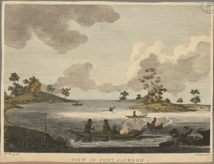
A woman’s place and fishing practices
Eora women’s skills in fishing, swimming, diving and canoeing were extraordinary.
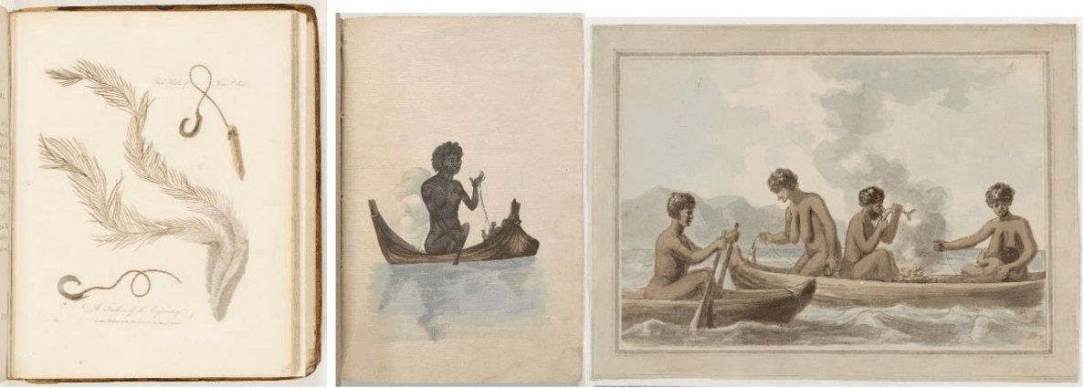
The women sang together as they fished and kept time with their paddles as they rowed. They were seen fishing all day, in all weathers, and at night too. Eora women dominated the waters of the harbours, coves and bays, and the coastlines in between. The men mostly only used canoes when they wanted to get from one cove to another.
waters of the harbours, coves and bays, and the coastlines in between. The men mostly only used canoes when they wanted to get from one cove to another.
Aboriginal women from the Sydney basin used to tie a material around a baby girl’s pinky finger just below the second joint. Once the pinky finger fell off, it was placed in the ocean. The removal of the finger is a practice known as ‘malgun’ which was performed for several reasons. Eora fisherwomen were hand and line fishers and without the pinky finger it made it easier for them to cast their line and carry out their fishing duties. Also the tradition of putting the finger into the ocean is to also symbolise and promote a sense of sustainability and appreciation of being able to give something back to the sea for taking something from it (fish).
Aboriginal women continued fishing the waters of Sydney Harbour at least until the late 1820s. Forty years after the First Fleet arrived, their canoes could still be seen skimming the waves, little plumes of smoke rising from the onboard fires.
A way of life
The Pyrmont area, known as Pirrama to its first inhabitants, was a location of rich resources. The eastern shore of Blackwattle Bay also contained freshwater springs and wells, including the named Tinkers Well that remained until destroyed through quarrying.
Streams of water can still be seen seeping through the seams of the sandstone escarpment where Bank Street becomes Bowman Street at the Pyrmont Peninsula.
1828
Land around Blackwattle Swamp is bough by slaughterhouse owners. Abattoirs and “boiling-down works” are established in the area.
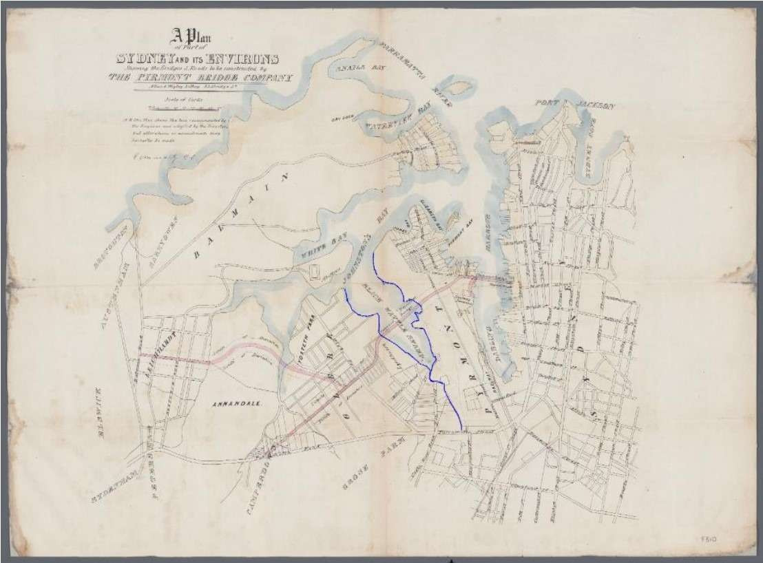
Allan and Wigley 1857 map showing Blackwattle Swamp and Blackwattle Creek (outlined in blue).
Source: National Library of Australia
1836
The activities of European colonists including violent attacks on Aboriginal people compounded the dislocation and destruction of the traditional life ways and homelands of Aboriginal people.
Blackwattle Bay maintained a distinct Aboriginal presence up to 1836 before being driven into Ultimo and further south as Edward Macarthur began to subdivide and clear the area (Ross 1988).
1839
By 1839 a small number of ship building and shipping businesses were established, taking advantage of the deep anchorage provided in the Bay.
1850
Improved City connections
Early subdivisions of the Pyrmont Peninsula were relatively unsuccessful due to the isolation of the peninsula from the city. The construction of the Pyrmont Bridge across Darling Harbour in the 1850’s linked the Peninsula to the city along with swift development of Darling Harbour
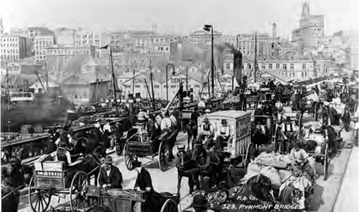
Pyrmont Bridge 1901
1855
Saunders ‘Paradise’ quarry
The tough quality of Pyrmont sandstone was well known by 1855. When the entrance and steps of the Australian Museum had to be replaced, the Colonial Architect insisted that the stone must come from the ‘best bed of the Pyrmont quarries’. Buildings using Pyrmont stone include Sydney University, the General Post Office and the Art Gallery of NSW, along with many other government buildings, insurance companies and banks. The quarries provided many jobs, but contributed to changing the peninsula from an attractive retreat to a place with a blasted, treeless appearance. ‘Paradise’ was one of several quarries run by the Saunders family. ‘Purgatory’ and ‘Hell Hole’ were further south on the peninsula.
1860
Timber industry
A jetty site was established, connecting Miller Street to the bay, provided merchants with direct access to shipping. D and W Robertson ship builders and iron and steel merchants and later the Saxton & Binns Timber Yard used the eastern side of Blackwattle Bay for industrial uses.
1877
Pyrmont Harbour Baths open
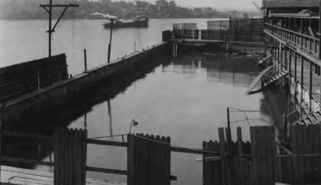
Derelict Pyrmont Baths
At the water’s edge, the kink in the boardwalk marks the spot of the much loved but ill-fated Pyrmont Baths: an icon of working class, industrial Pyrmont. In 1872, Pyrmont residents petitioned the council for the construction of public baths, which opened in 1877. The pool was tidal, and the floor was sand. It became a central meeting place for the amenity starved residents of Pyrmont and Ultimo.
Source: City of Sydney 2021, Port History Walk Pyrmont
1876
Reclaimed land
Blackwattle Bay and its surrounds have been subject to large scale alteration including land reclamation to form bays and wharves. In effect the southwest and southeast shorelines of Blackwattle Bay are wholly artificial landforms for up to several hundred meters inland.
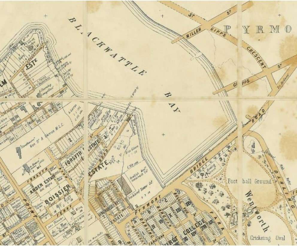
Natural foreshore of Blackwattle Bay. Sands Directory Map 1887.
Source: Historical Atlas of Sydney
Land reclamation at Blackwattle Bay. Higginbotham and Robinson 1886.
Source: National Library of Australia/Trove
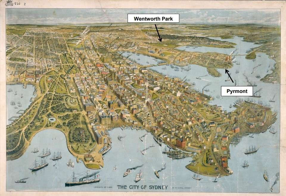
Depiction of Sydney circa 1888 with Pyrmont and Wentworth Park labelled for context.
Note that Wentworth Park already appears to haveundergone land reclamation (Hill 1888)
Blackwattle Swamp and Creek are filled in and Wentworth Park created on the reclaimed land as “a place of public recreation”.
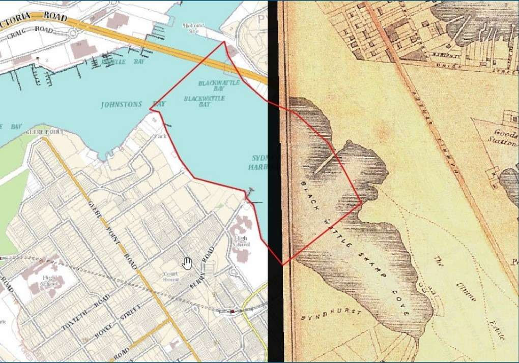
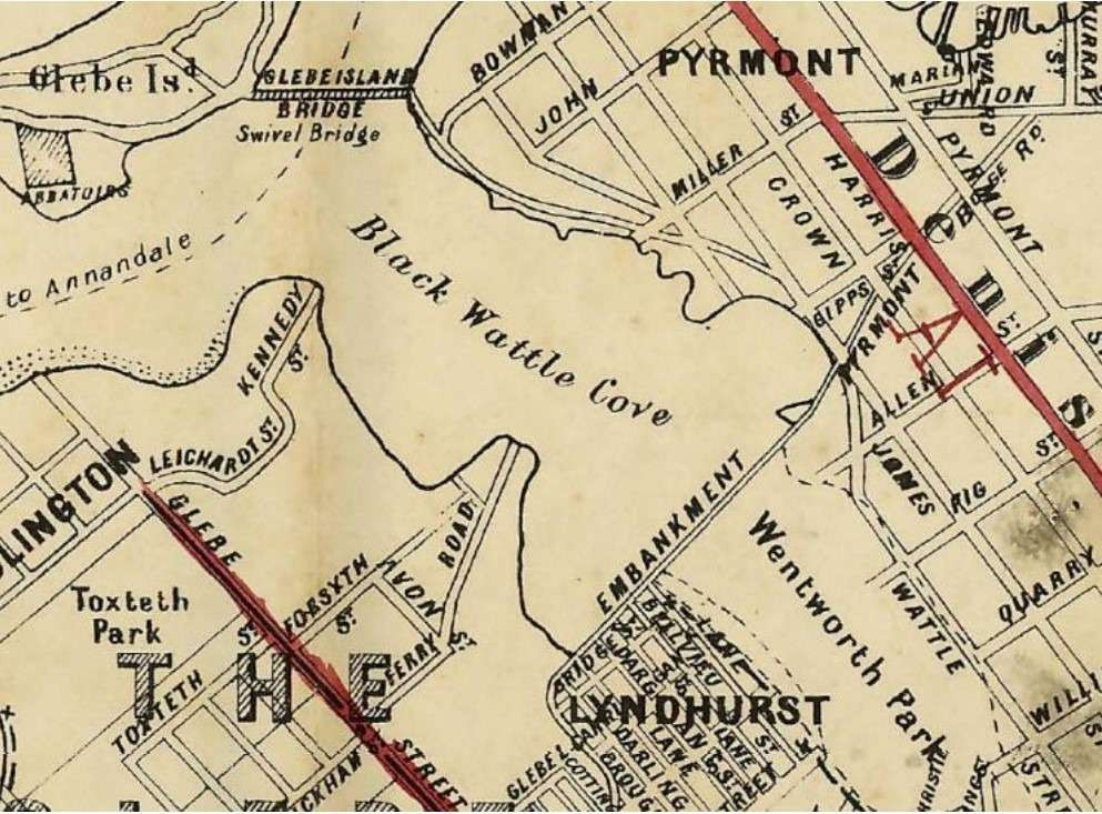
Overlay by Comber Consultants of study area over portion of a 1855 map (Spence & Gardiner –right hand side of Figure)
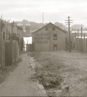
1879
Glebe Rowing Club is established at Blackwattle Bay
In 1883, Glebe Rowing Club conducts its first regatta: no entrance fees and prizes of ‘smoking caps, cushions and slippers provided by hands of ladies in the borough’.
1885
A seawall and timber wharf was constructed on the north side of Bridge Road in the newly reclaimed land.
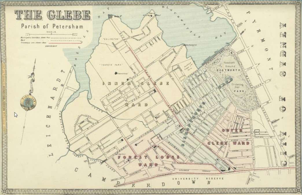
1886 map, The Glebe, (NLA MAP RaA 40 Plate 198)showing reclaimed Wentworth Park.
1903
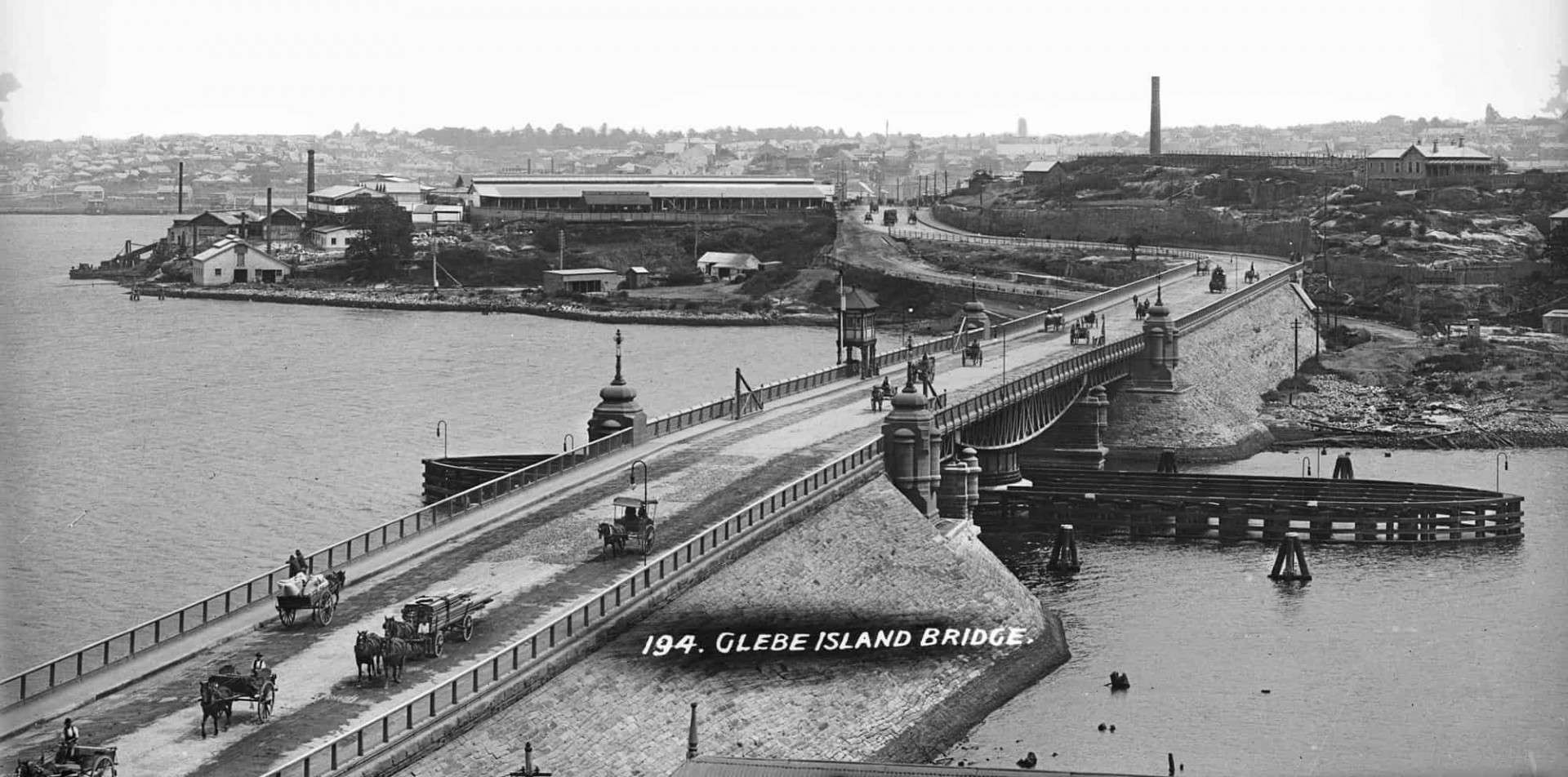
Glebe Island Bridge
A new swing bridge replaces the old Glebe Island Bridge to allow for the passage of ships into the bays.
1914
WWI
As an established shipping area, Blackwattle Bay played a vital strategic role during wartime. Its strategic role became vital – with people and goods moved almost exclusively by sea until 1960s. Wentworth Park also played a crucial role, being used for years to accommodate wool sheds.
1917
Establishing White Bay Power Station
The White Bay Power Station was constructed with electric substations built on the bulk handling wharf area joining Pyrmont Bridge Road.
White Bay Power Station
1919
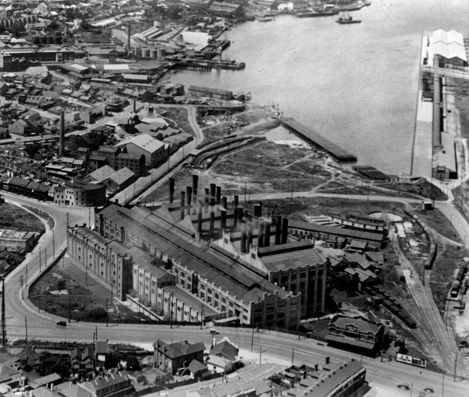
Timber industry
A wharfage plan of Blackwattle Bay from 1919 shows that the Bay’s eastern shoreline, including Bank Street, was taken up by wharves associated with the Allen Taylor & Co. Ltd. Timber yards. As a part of the company’s timber business, it also owned a number of ships.
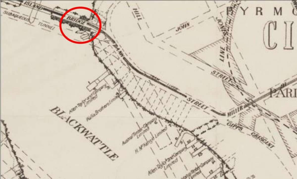
Extract from a map of the wharfage accommodation plan of the Port of Sydney, 1919 with the area of 1-3 Bank Street circled in red.
Source: Sydney Harbour Trust. State Library New South Wales file no. a5447001
1920
Concrete batching plant
Hanson Heidelberg Cement concrete batching plant established on north side of bridge road until being demolished in 2020.

Hanson Heidelberg Cement wharf area prior to demolition in 2020 (Comber, 2021)
1922
The industrial belt
Following the construction of the Goods Line Railway, heavy industry claimed the perimeter of the harbour in White Bay, Johnstons Bay, Blackwattle Bay and Darling Harbour. This was also known as the ‘industrial belt’.
1940s
Evolving industries
The brick warehouses at 1-3 Bank Street have been constructed in a style typical of the Inter-War period and appears on imagery from 1943.
This item has had a long association with the Blackwattle Bay timber industry and later as the base of the Cam and Sons fishing trawler fleet, where it continuously operated for over thirty years.
Later uses included Colonial Sugar Refining Co Ltd, Shell Service Station, Fork Lift Pty Ltd.
1964
Sydney Fish Market relocated to Blackwattle Bay
Sydney Fish Market moves to Blackwattle Bay from Haymarket.
1975
Bank Street Wharf
By 1975 the Bank Street wharf was occupied by the Forklift Hire Co. At this time the wharf was still intact with the boat shed above the wharf retained as a complete building from Cam and Sons’ operating days.
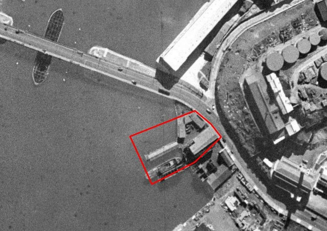
1943 aerial photograph of Pyrmont, with 1-3 Bank Street outlined in red
Source: SIX Maps 2016
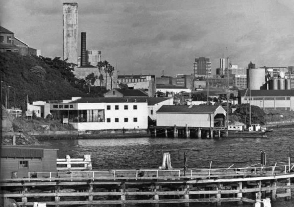
A view of the site taken from the Glebe Island Bridge in 1976. At this time the Forklift Hire Co. occupied the site
Source: City of Sydney Archives online, 067/067929
1983
White Bay Power Station is decommissioned
1995
The Anzac Bridge is opened and the old swing bridge decommissioned.
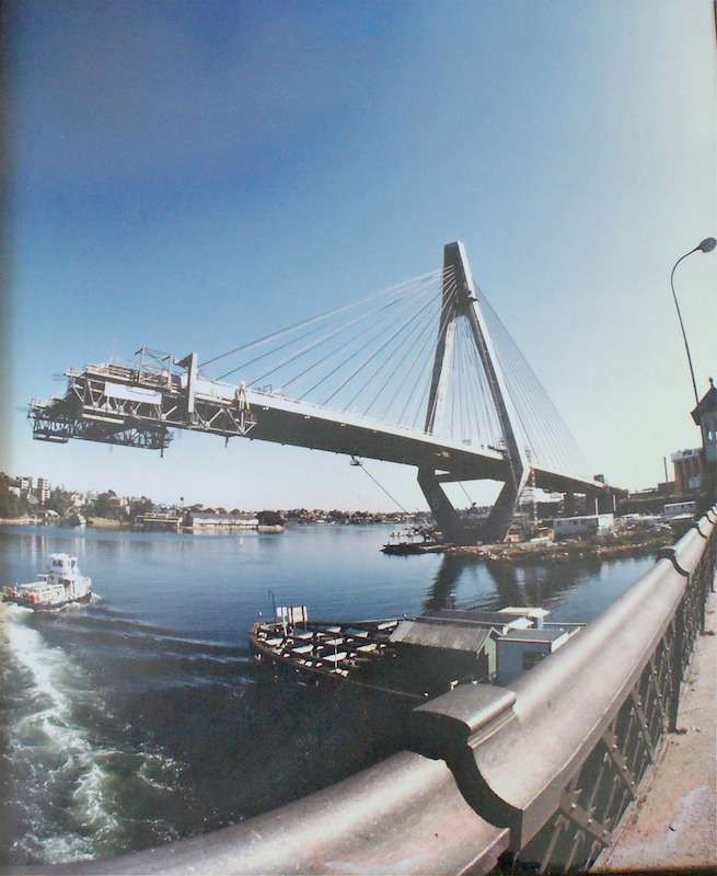
Anzac Bridge Construction, 1994
Source: Pyrmont History Group
2015
The Bays Renewal began in 1993 with a ‘City West Urban Strategy’ for the Bays Precinct. Subsequent strategies were released in 2005 and 2010. Urban renewal began to take shape in 2015 with the Call for Great Ideas, followed by the Transformation Plan in 2017 and the State Significant Precinct Study in 2021.
The Blackwattle Bay Journey
We recognise the input of Aboriginal people and cultural knowledge into the Precinct Planning process, and we recognise the value that knowledge gives to the Precinct.
The information available on this page has been sourced from a variety of studies carried out for the Precinct Planning of Blackwattle Bay. The documents linked below have been summarised into an interactive indicative timeline for this page.
An extensive range of technical reports, historic research and consultation has been carried out in preparation of the State Significant Precinct Study.